 Facebook
  Twitter
  Reddit
  LinkedIn
  Email
Email  Copy URL
 Can technology advance conservation? ProtectedSeas provides open data and monitoring solutions to enhance awareness and compliance of ocean protections. Please read the following interview with Director Virgil Zetterlind of ProtectedSeas, to see how ProtectedSeas’ activities using technology to enable a sustainable future and what future we want to create.

Virgil Zetterlind
Director of ProtectedSeas (https://protectedseas.net)
the web and mobile phones. It also developed a lower-cost solution for monitoring nearshore Marine Protected Areas (MPAs) that uses off-the-shelf radars to provide 24/7 situational awareness. These are the main activity of ProtectedSeas led by Virgil Zetterlind. He is a leading expert in remote sensing, mobile/web mapping, and processing and visualization of GIS Data. He has worked on various research and development projects for US Air Force, Navy, Google Earth, and NASA. Marine Conservation technology for the sustainable ocean has been his passion since he fell in love with the ocean when he moved to Florida in 2020
Technology for Sustainable Oceans
Could you give some background information regarding ProtectedSeas? What do you do at ProtectedSeas?
ProtectedSeas is a marine conservation organization associated with the Anthropocene Institute. We have developed a free digital map of MPAs available online and a radar system(M2) to protect vulnerable areas from illegal activity.
As a director, I manage day-to-day operations for our project teams and ensure they have the resources they need to do their work. My role also includes representing the company at public events and managing various partnerships with NGOs and governmental organizations. I get to do hands-on software development for both the MPA mapping and Marine Monitor (M2) projects. Across our portfolio, I oversee the cloud and database services and manage technical requirements and progress reviews.
Please describe the members of ProtectedSeas and their roles.
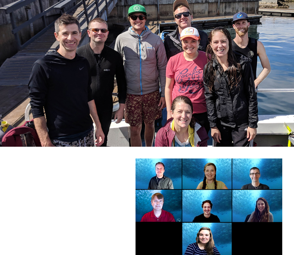
MPA mapping project team consists of two environmental attorneys with ocean law backgrounds and two full-time Geospatial Information System (GIS) analysts. The attorneys conduct extensive research and reading of the laws and regulations that govern protected areas, and the GIS analysts carry out data management and mapping. The M2 project employs a project manager and a dedicated application engineer. The project manager oversees site developments and hardware deployments. The application engineer maintains the software on all systems, improves the software tools to detect illegal behavior, and conducts boater activity analysis. We hire contractors as needed for research and translation.
We are a small team but work closely with many government, NGO, and academic partners. Our MPA data is shared with the NOAA MPA Center through a public-private partnership. Data sharing partnerships are in place with many NGOs, including COBI (Mexico), MedPAN (Meditteranean), Marvida (Panama), OSPAR (North Atlantic), Pew (Caribbean), TNC (Pacific & Caribbean), and Global Fishing Watch.
Is Korea also included in ProtectedSeas' MPA Map? How did ProtectedSeas start to cooperate with NCSOFT?
Currently, the MPA map includes regulations and MPA data of 48 countries, including South Korea and provides this information in 13 languages, including English and Korean.
During our Marine Protected Area mapping project, we needed assistance in researching and translating information about South Korea’s Marine Protected Areas. We remembered that we had met Dr. Songyee Yoon and had learned that she loved the sea. We reached out to her, and she connected us to NC, who provided significant assistance to make connections in South Korea. Those contacts made sure we had all the information we needed to map Korea’s MPAs correctly. Dr. Songyee Yoon and NC's assistance were invaluable.
What do you think about the current situation of marine protected areas in South Korea?
By our calculations, South Korea has protected less than 2% of its Exclusive Economic Zone through the designation of MPAs. The policymakers need to pay attention to the sufficiency of the current protection level for preserving fish stocks and other marine life and make timely decisions. In case further enhancement is needed to meet UN SDG and other goals, South Korea can benefit from our maps to identify the most effective regulation scenarios with given ecology and other considerations.
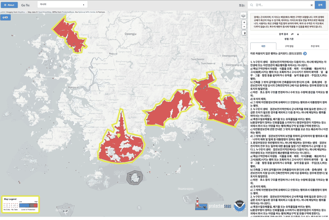
ProtectedSeas' MPA map showing the marine protected areas in South Korea
Understanding Human Impact Is Key to Conservation
What is the most critical issue or topic in ocean conservation?
Measuring human impact is a critical component of ocean conservation. Human impact takes many forms ,including fishing, pollution, and underwater noise. Only by understanding the impacts of human activities can we create useful solutions that protect vulnerable ecosystems while providing sustainable food and income to communities that rely on the ocean for their survival.
I believe it is imperative to increase transparency around human use of the oceans and its impact is a necessary input for appropriate management decisions and improve the public awareness.
What role can technology play in protecting our environment?
Wise application of technology can be a force multiplier, allowing fewer people to have a larger impact for a lower cost. Technology can also extend human capabilities and awareness for protecting nature thus allowing us to formulate measures to protect the marine environment based on the accurate understanding of reality .
For example, ProtectedSeas’ MPA information is available online in a standard format across countries, which can certainly assist with enabling fishermen and other parties extracting resources to be aware of regulations so that conservation can be furthered. This information can be used by governments to create fishing regulations or more MPAs in places that have a higher ecological impact and can measurably improve fisheries.
International organizations will now have the information they need on the protection of pelagic species, such as whales, tuna, and turtles. The internet technology enabled consolidation of information and consequently will inform decision making and efforts to improve regional cooperation.
Our effort uses technology to display information useful for conservation but is not sufficient. Conservation is primarily people-driven. It is people’s duties to decide how to use technology and make decisions. Thus, the successful application of technologies must consider the human element.
What future technology are you paying particular attention to for ocean conservation?
Low-cost space-based internet will be a game-changer for ocean monitoring and conservation. Obtaining real-time data from the ocean has historically been one of the hardest and most expensive challenges. We are excited at the progress being made to provide internet at sea and the opportunities that it will provide for a much wider deployment of ocean sensors of all types.
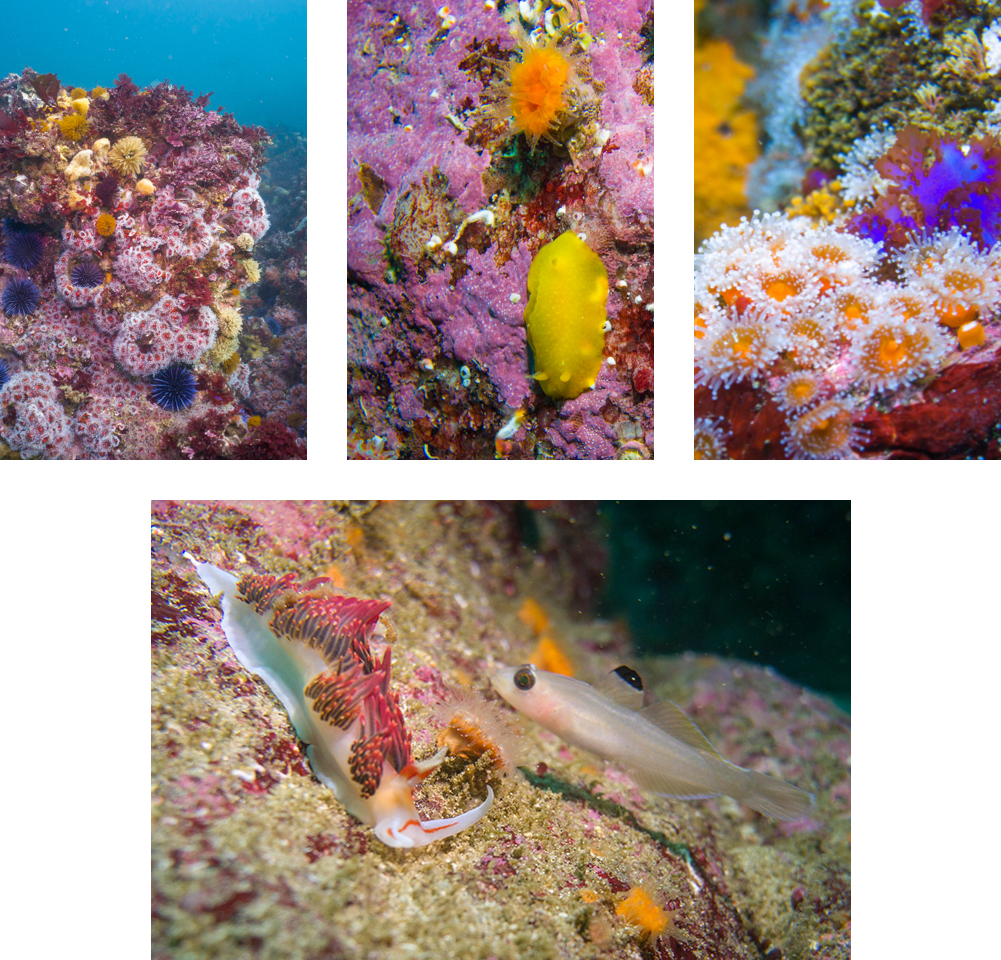
Also, further development in technologies is needed to monitor and quantify biodiversity. Environmental DNA is making strides, as is artificial intelligence to quickly assess the health of fish stocks. We need to understand the distribution of biodiversity and how it changes to protect it for future generations.
What kind of government support or private efforts will be needed in the future to protect the ocean?
Private organizations and small communities make large contributions to conservation – especially for nearshore reefs and estuaries that are critical breeding grounds for many species. In the high seas, which lack many protections because they are outside national borders, international efforts are needed to create enforceable regulations for sustainable resource use.
Science and technology are tools but alone cannot solve the challenges of marine conservation. Some of the thorniest issues of marine conservation are transboundary and require international cooperation. Climate-change-induced ocean acidification and protection of species that cross borders are such examples, which needs to be addressed with supranational efforts in compliance with the Paris Climate Agreement and other relevant international agreements.
Studies have proven that the designation of MPAs has improved biodiversity both within and outside the area. Thus, properly designed and located protected areas should increase overall ocean productivity for humans while giving vulnerable species places to recover and thrive.
The Sea Is an Infinite Source of Inspiration
What made you interested in ocean conservation?
Growing up in the land-locked state of Ohio, I always enjoyed the outdoors. After moving to Florida in 2002, I fell in love with the ocean and started boating. When I worked in a software company previously, I started building applications to help protect whales, sharks, and manatees. These apps also meant meeting many great people involved in conservation work.
What was the biggest challenge you’ve faced at ProtectedSeas?
Gathering detailed information on MPAs in every country in the world is a huge task for a small team. We overcame it by partnering extensively with regional NGOs around the world to help gather data where it is not readily available.
More recently, we have also started hiring local ocean law experts in hard to map countries to gather and translate information. Even as we map more and more difficult areas, our mapping speed continues to increase through our lessons learned to date.
What does it mean for you to work at ProtectedSeas?
ProtectedSeas offered a unique opportunity to help solve conservation challenges through software and technology. Although small, our team is very diverse and motivated. We share a passion for environmental conservation. I value the ability to make direct contributions to improving our environment and enjoy working for responsive organizations that are outcome vs. process focused.
What inspired or motivated you to work with ProtectedSeas?
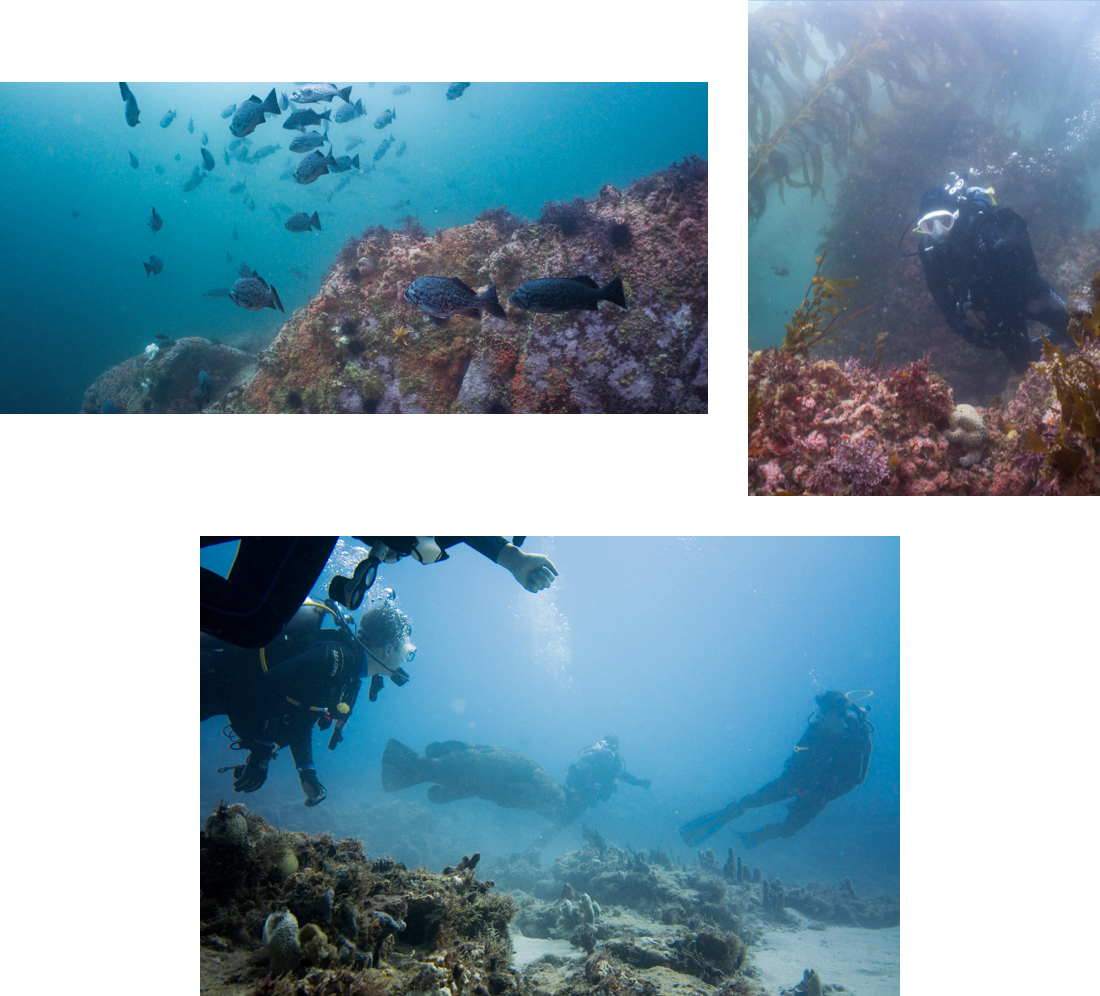
Enjoying the ocean is a key motivator. Since joining ProtectedSeas, I have become an avid scuba diver and divemaster, which lets me experience the ocean and its wonders firsthand. I am also passionate about boating and sailing; I want to continue to enjoy the beauty and the wonder of the sea.
What would you like to accomplish at ProtectedSeas? What is your personal goal?
ProtectedSeas will complete global coverage of the MPA map by 2022; soon, MPA regulations will be available on all boats around the world, making it easier for communities to know where and how to protect their marine resources.
Our goal is to ensure transparency of marine conservation information so that everyone can respect the rules created, preserve protected areas, and promote and encourage the sustainability and habitability of the planet for future generations. We dream of MPA data serving as the foundation for exceeding the UN goal of preserving 30% of the ocean by 2030. We want to see the continuing expansion of positive impacts and experiences of the activities of ProtectedSeas.
Finally, I hope that COVID-19 crisis will come to an end soon so that I can travel internationally again and scuba dive in new places.
* The opinions expressed in this article are those of the interviewee and do not reflect the official position of any of NCSOFT.